Race report: SEOUL Nailsworth
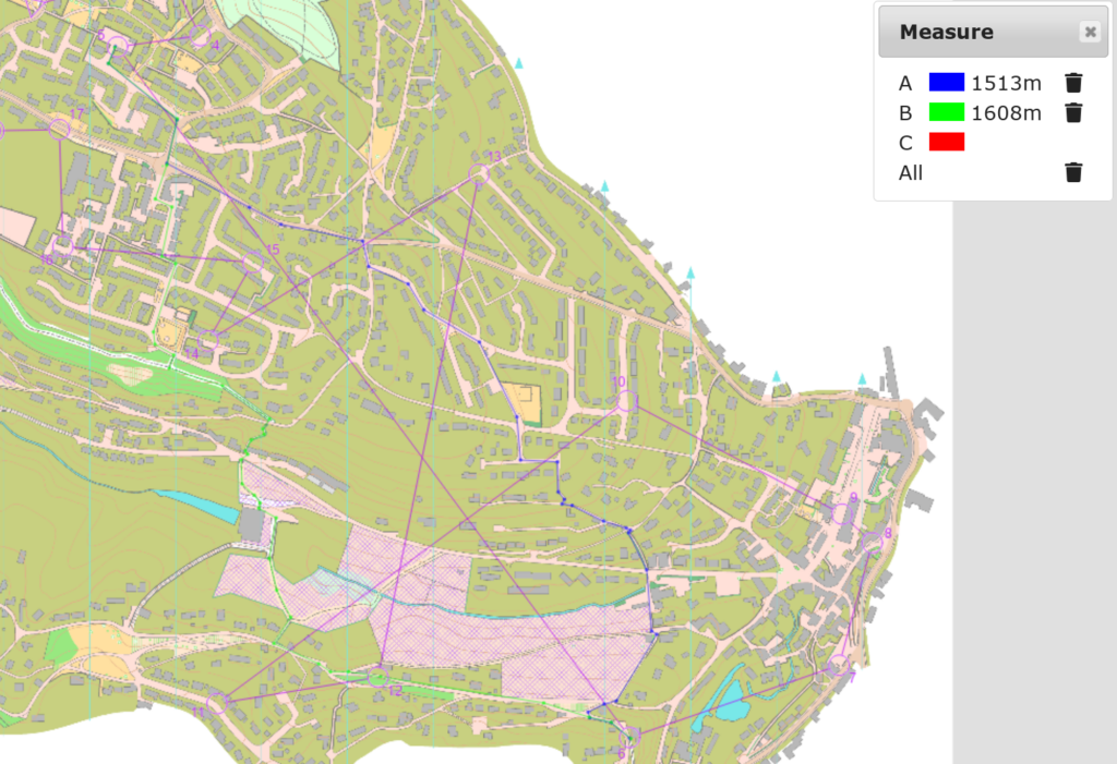
On the summer bank holiday, I went to Nailsworth to race orienteering. It was a very steep courses with plenty of route choices and contour reading.
In order to save words I ain’t going to show every leg here, only those with significant route choices.
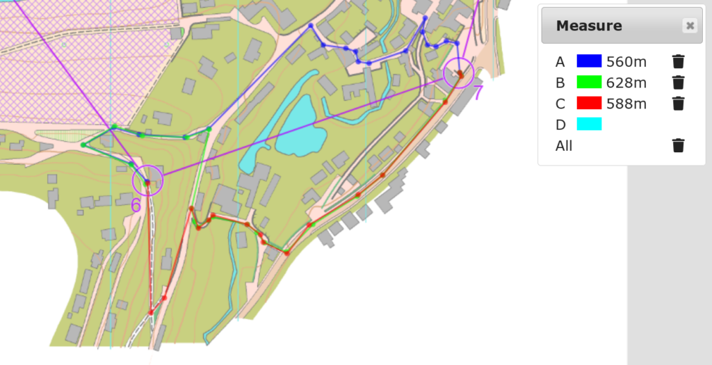
5 to 6
I and the majority of people used the blue route (1513 m), but a few used the green route (1608 m). There were 7 up-contours after the valley on the final part of the leg in the blue route, but only 5 in the green route. As the contour interval was 5 m, it meant 10 m less climb in the green route, which could be approximated into 100 m of running. However, according to the split analysis, the blue route was better, and I still had 51 seconds of mistake time following the blue route (probably due to the the slowness of the climb involved).
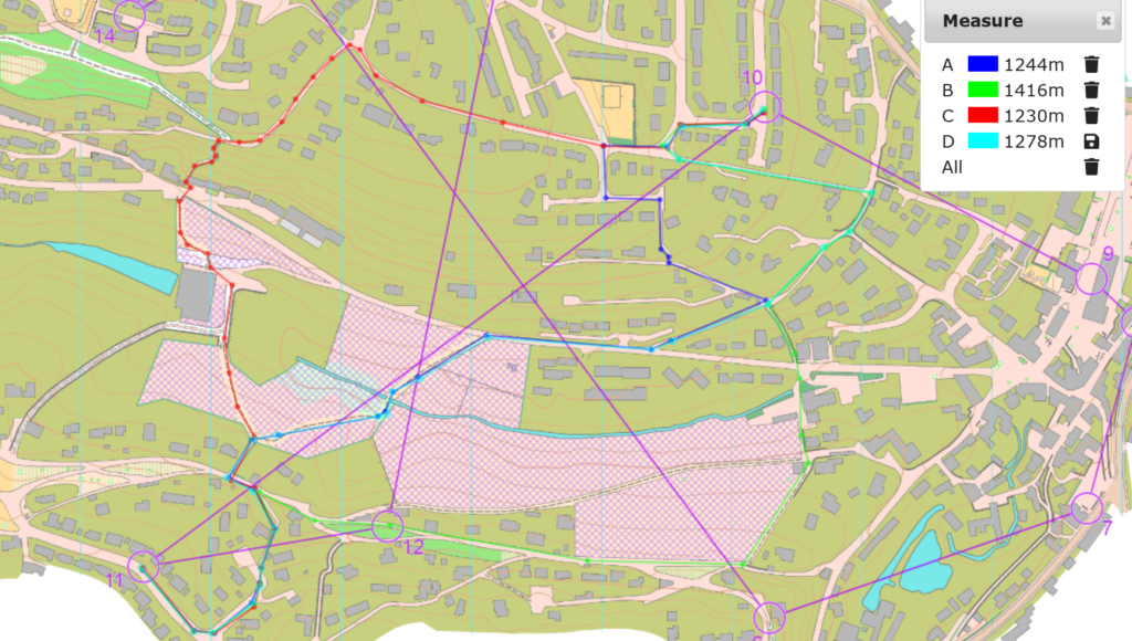
6 to 7
The shortest route was the blue one but it involved one more contour than the red one. The majority used the blue one. However, I ran the green one (628 m) not realising that it was much longer than the red one (588 m). I logged 20 seconds mistake time by the analysis. There was no significant difference between the blue and red choices.
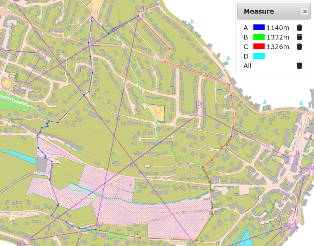
10 to 11
I followed the green route (1416 m) as an attempt to avoid climbs but it was much longer than the blue (1243 m) and red routes (1230 m). From the forking point to the merging point, the blue route had 9 up-contours (45 m climb), the red route also had 9 contours but more were in the beginning, and the green route had just 6 contours (30 m climb). That meant I saved 15 m of climb but ran 186 m more. Using the 1 m climb = 10 m run conversion, I made my detour too long to avoid the climb. However, the best route would be the cyan route (1278 m), which followed the green route initially to avoid the climb, then joined the blue route for the short way to the control, only having 7 contours (35 m climb). My mistake time was 2:41.
12 to 13
The blue route (1140 m) was the shortest which most people used, and, again, I went a long way out, using the red route (1326 m) to avoid the climb. There were 13 up-contours (65 m climb) on the blue route, and only 7 (35 m climb) on the red route, so the detour was worth it. I got negative mistake time by using the long way round, while those who used the short route on the GPS track all had positive mistake time.
Result
I got the 9th out of 13 in MO, completing the course in 1:00:26 with winning time 0:40:32. There would be no way for me to get 20 minutes out of the course even if I didn’t made the mistake shown above.
It really seems that it’s unlikely to get my urban orienteering improved to the winning standard, as even if I get a perfect run I won’t be able to catch up the winner.