Race report: Lincoln City Race
I went to the University of Lincoln earlier today to participate in Lincoln City Race, organised by Lincoln Orienteering Group (LOG), which is the 16th race of the UK Urban League this year.
Journey to the race
The event centre is approximately 1.1 km from Lincoln train station, therefore in order to get there I just need to take the train. The normal route for me to get from my home, Cricklewood, to Lincoln is to take a Thameslink train to London St Pancras, walk to London Kings Cross, and take an LNER train to Lincoln. As this is a long distance journey, it is much cheaper to buy a non-refundable advance purchase ticket compared to buying on the day, with a seat guaranteed as well.
I bought a pair of train tickets on 27 July, from Cricklewood to Lincoln and from Lincoln to Cricklewood forming the outward and return journeys, both being advance purchase tickets routed LNER & connections and priced £12.7, i.e. £25.4 in total. However, I used £5.55 worth of LNER Perks credit towards this purchase, so I only paid £19.85 by my payment card. I selected the Thameslink train scheduled to depart Cricklewood at 08:38 to London St Pancras, connecting to the LNER train scheduled to depart London Kings Cross at 09:33 to Lincoln arriving 11:29, the first train of the day on this route, to be outward journey, then 12:00 – 12:14 as my start block for the race, and the LNER train scheduled to depart Lincoln at 14:20 back to London Kings Cross, connecting to the Thameslink train scheduled to depart London St Pancras at 16:54 arriving Cricklewood 17:05 as the return journey.
However, on 7 August, I received an email from LNER telling that my train had been cancelled. It turned out that the Thameslink train departing Cricklewood at 08:38 had disappeared with the route bustituted. I had some bad experience in using rail replacement buses before and would like to avoid them if I can, however, as there isn’t another railway station close to my home, the use of bus was unavoidable so I rebooked my journey anyway, on a replacement bus departing Cricklewood at 08:42, connecting to a train departing West Hampstead Thameslink at 09:00 before joining the originally booked LNER train.
I arrived the bus stop outside the train station 5 minutes before the scheduled departure time, 08:37. There is a local bus route, C11, which also runs on the same route to West Hampstead as well but a train ticket cannot be used on local buses so I would need to pay £1.65 if I used it. However, it was scheduled to depart at 08:40 (2 minutes before the rail replacement bus), and the next one would be at 09:00 (which would be too late to connect to a train at West Hampstead Thameslink to get to Kings Cross on time for the long distance train to Lincoln), so it couldn’t be used as a backup option if the rail replacement bus didn’t show up on time. I saw a C11 bus passed the stop on time at 08:40, however, at 08:42, I saw nothing turned up. I couldn’t see a rail replacement bus at the stop at all until 08:50:00 so the rubbish Thameslink service failed me. I was running out of the time to catch the train departing West Hampstead Thameslink, 2 km away, at 09:00 (the rail replacement bus was scheduled to take 10 minutes from Cricklewood to West Hampstead), and I had to run that 2 km at race speed to the next train station as the last resort in order to avoid a delay to my journey. I boarded the train just in time, at 08:59:20 (the train doors may close up to 30 seconds before departure), and arrived London St Pancras on time for the long-distance train.
I boarded the long-distance train at London Kings Cross scheduled to depart at 09:33 to Lincoln. However, it didn’t depart on time as the train manager was late due to a cancelled Peterborough – London service (which was also run by Thameslink – they always cancel trains due to a shortage of train crew). The delay was recovered during the journey and I arrived Lincoln on time.
The race
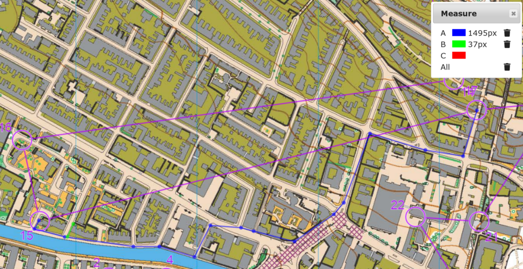
I did the category matching my age group, which was MO, on course 1, 8.3 km in length and 110 m climb. Like any orienteering races, expect the actual run to be much longer than stated.
Controls 1 to 4
The race began with some typical sprint legs in the university accommodation. I ran through them at steady pace.
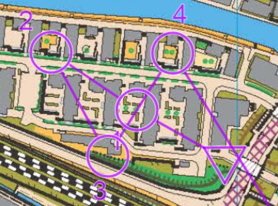
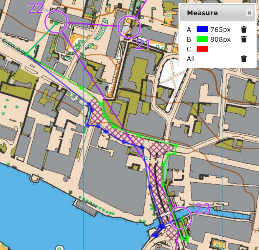
Control 5
This was the first long leg in the race which offered route choices. I ran the blue route A (1263 m) which, despite not looking the shortest, could likely offer the fastest run along a main road, however, it seemed that the green route B (1152 m), running along the riverside and using a railway level crossing (which a bridge is available if it is shut), would be the best option. Route A involved 1 set of stairs, route B involved none if the railway crossing wasn’t shut, and route C involved 2.
According to the Sakurai-Tori O-Lap analysis method, my mistake time at this leg was 14 seconds.
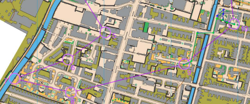
Control 6
There were two obvious route choices, to cut through the inside of the estate (A, blue) or not (B, green). I chose to cut through it.
Route A was 270 m and route B was 283 m, by cutting through it I saved 13 m and the analysis returned a negative mistake time of -6 seconds here.
Controls 7 to 10
There were no significant route choices here but I made a mistake while approaching control 10, after running too fast through control 9. I missed the entrance of the estate and ran the blue route instead but I should enter the estate using the green route.
The analysis showed that I ran 13 seconds faster than I should run to control 9, and lost 27 seconds in control 10.
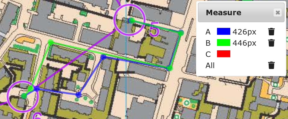
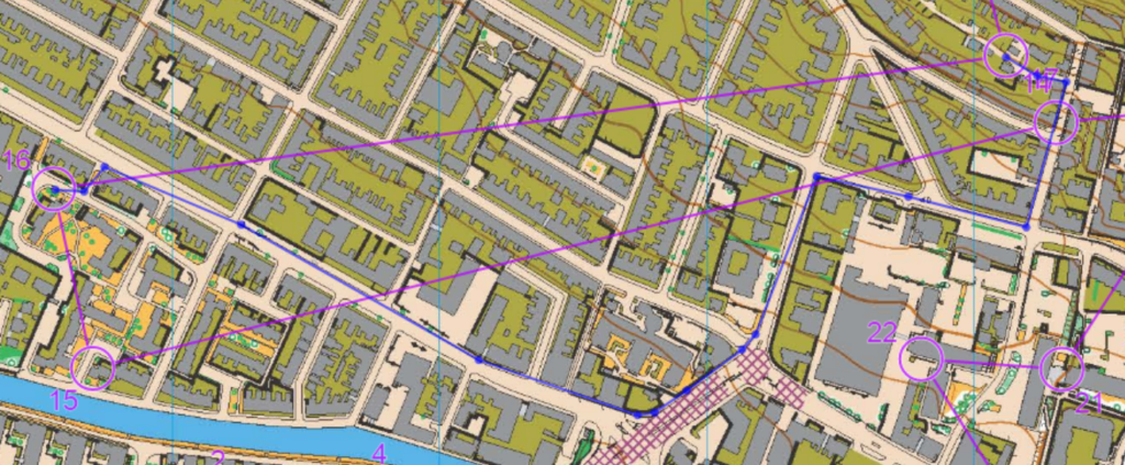
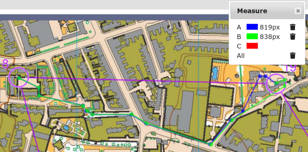
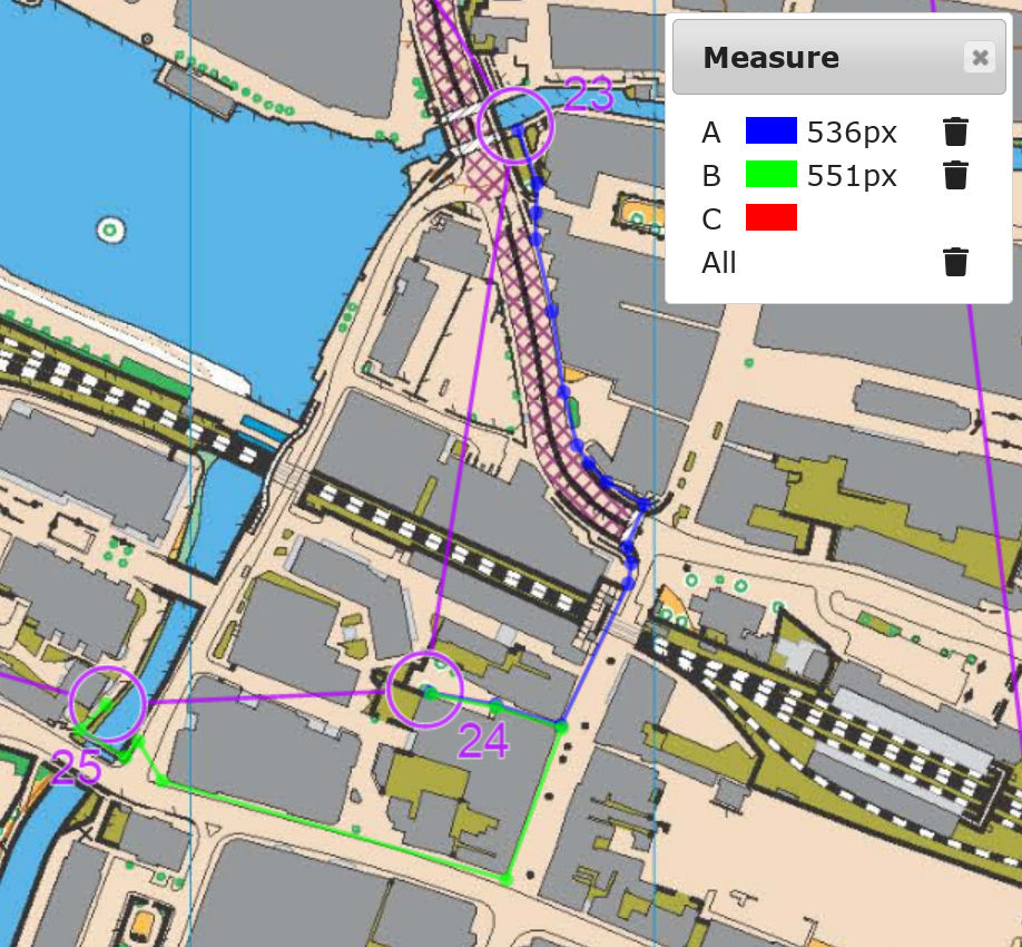
Control 11
I had to have a complete stop after punching control 10 as I ran out of fitness. This was a long leg with route choices. There were 2 obvious routes – where to cross the railway, with the blue route A using a footbridge to the east, and the green route B using the level crossing on the high street. I ran route A. However, I made another mistake executing the route choice. I turned left too early just after the river (shown in red as route C) whereas I should turn left after a further block after the river (shown in blue as route A).
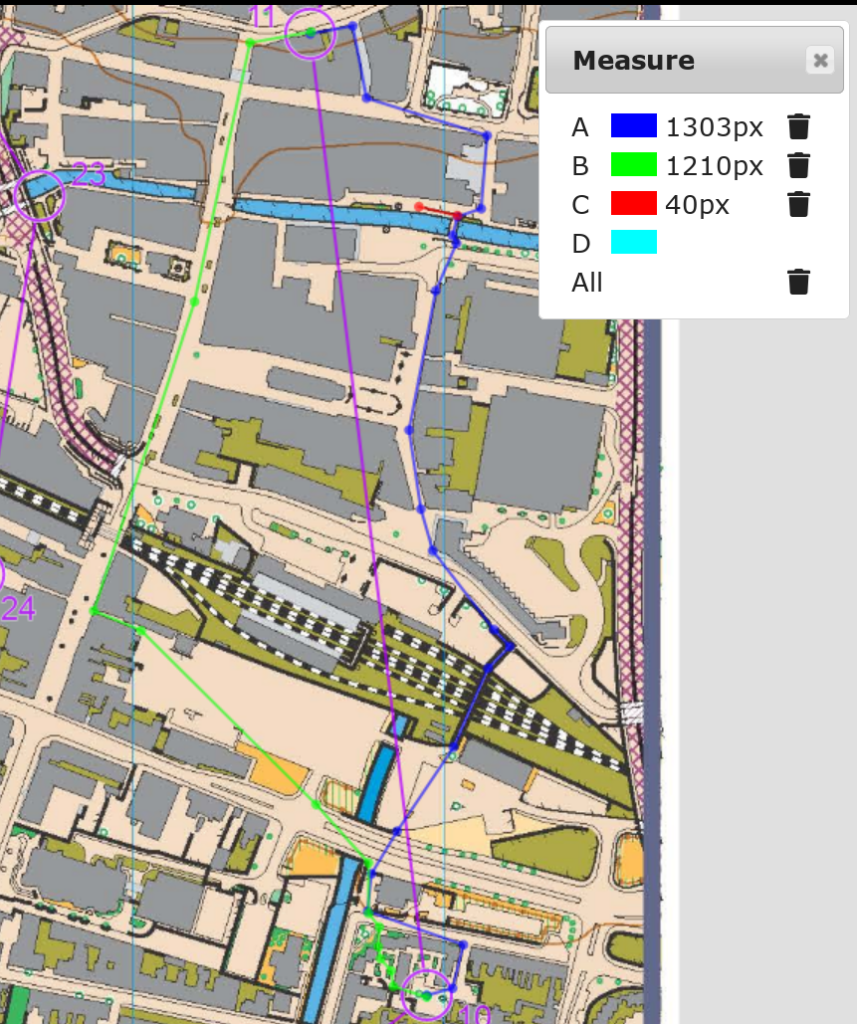
In addition, my route was suboptimal again. Even if I didn’t make the turning mistake, route A (using the footbridge) was 827 m long and route B (using the level crossing) was just 768 m long, and there were no stairs on route B if the level crossing was open. My mistake as shown in the analysis was a massive 32 seconds.
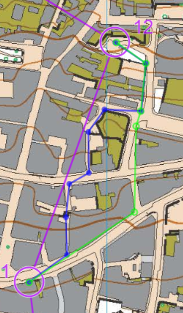
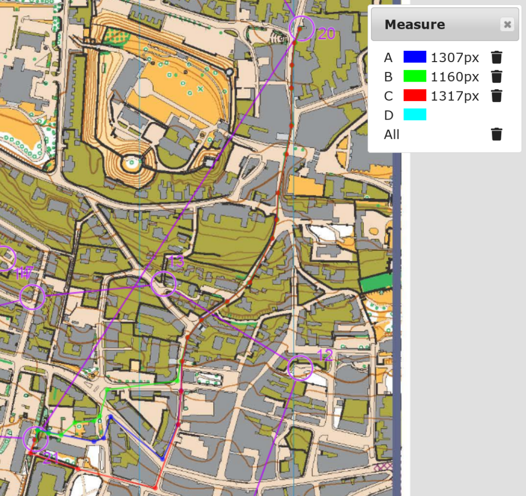
Control 12
There are 2 obvious route choices, A (blue) and B (green) which I took A. However, it turned out that B was slightly shorter, 344 m vs 364 m on A. It was a uphill leg which slowed me down a lot, with the analysis showing that I was 16 seconds slower than expected.
Control 13
There are 2 obvious route choices, route A (blue) going down then up, route B (green) going up then down.
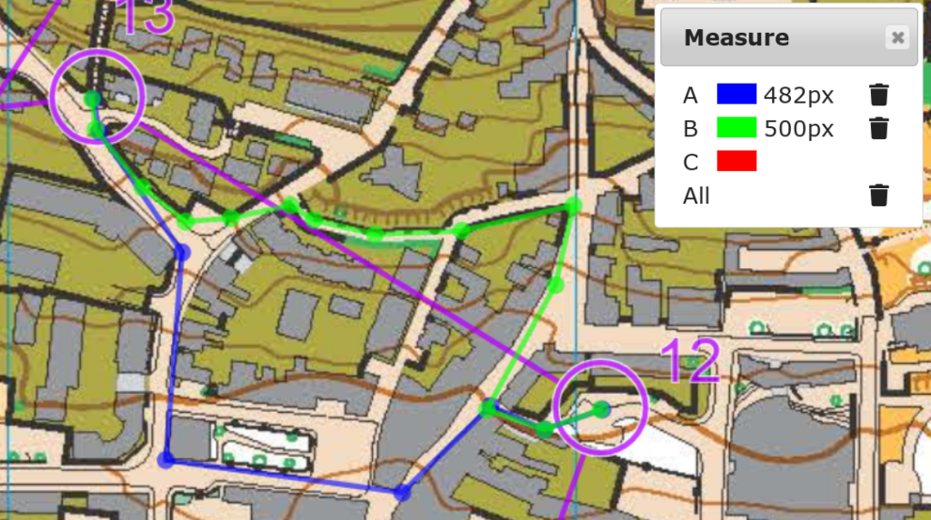
For this kind of choices, I always go down then up in order to have the maximum speed on the bottom. However, as the climb was so steep, I slowed down to a crawl and the analysis showed me 35 seconds mistake time.
Control 14
The direct line is blocked by impassable barriers and it’s again either go down then up (routes A (blue) and B (green)) or go up then down (route C (red)).
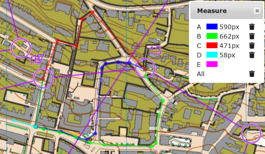
As always I chose down then up in order to maximise my speed. However, I ran too fast downhill and after the turn I ran past the junction at excessive speed (shown as route D (cyan)). I had to stop and turn back, which meant I couldn’t use the momentum gained from the downhill to run uphill towards the control. The analysis showed that this mistake cost me 22 seconds.
The up-then-down route C (red) was 299 m while the down-then-up route A (blue) was 375 m. However, route C would likely be much slower than route A because it would be a crawl to the stop and a significant length of downhill slope would be required to get the speed back, which made the speed much slower than route A.
Control 15
Control 15 is a long leg. I used the blue route A (949 m) which went downhill as soon as possible in order to get me speed which I could keep through the flat section afterwards.
However, I made mistake again while approaching the control – turned right too early (B, green). The mistake time in the analysis was 4 seconds.
Control 16
My planned route was the blue route A but I was in a bit of confused state after some long fast running, and I went too left while exiting control 15 – another 6 seconds lost.
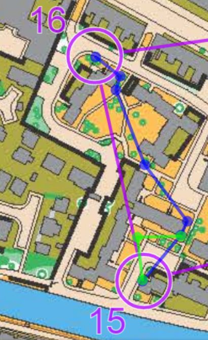
Control 17
I used the same route back as I came, shown in blue (1045 m). However, as steep climb was involved, I had to slow down to a crawl again which the analysis algorithm thought that I made 57 seconds of mistake here.
Control 18
This is a meaningless leg just to slow me down, as the only sensible route is the one shown in blue below (735 m) with a very steep climb. It was a long crawl before I reached the top of the hill before I could run again. The analysis showed it as a 50 seconds “mistake”.
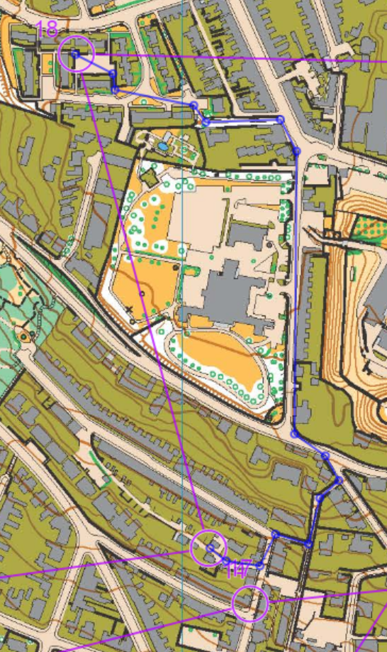
Control 19
There is a choice of how to approach the control behind the building, which is shown as A (blue) and B (green) below. I chose A which was shorter by 12 m. The analysis showed that I gained 7 seconds in this leg.
Control 20
There are 2 choices, A (blue) and B (green). I chose A.
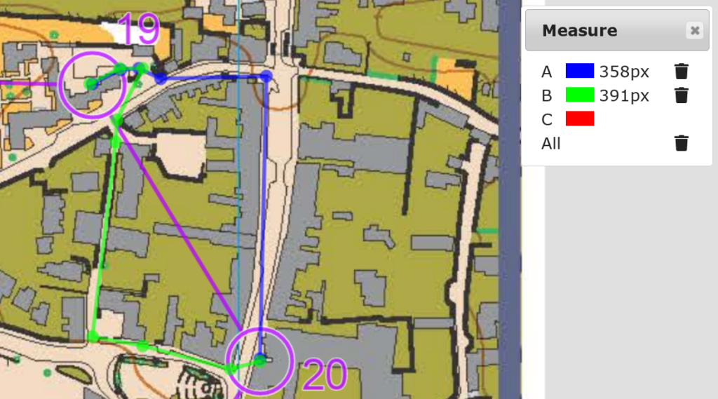
A was 227 m and B was 248 m. Despite having chosen correctly I still made 23 seconds of mistake here as I ran out of fitness again after fast running to control 19, and went very slow towards 20. I stopped after punching control 19 and stopped once more while approaching 20.
Control 21
It is a long downhill leg so I can gain a lot of speed here. I ran the blue route A.
However, it was a mistake as the green route B was much shorter by 93 m, and the zigzag on my blue route A forced me to slow down for the final section. It cost me 23 seconds.
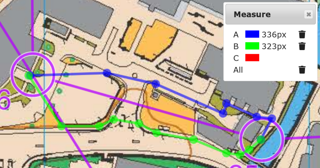
Control 22
There are 2 possible routes by reading the map, blue route A and green route B. B is a bit shorter but it involve jumping over a passable fence. As it would be much longer to zigzag around it, I chose A.
However, it turned out that THE MAP WAS WRONG!!!!!!!!! The final part of the blue route A was blocked off by a locked high fence rendering it impassable on the ground!!!!!!!!! I stopped for minutes and read the map repeatedly, and eventually I was forced to follow the red route to the control. I took nearly 3 minutes extra because of this.
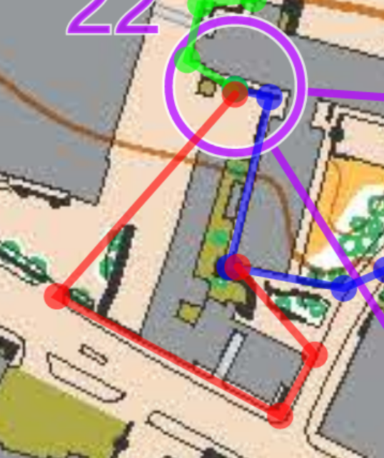
This had made the race effectively unfair. When taken seriously, it would result in the race being voided. From the analysis sheet, the athletes ranked the 2nd to the 5th all made a “mistake” of about a minute such a short leg here.
Control 23
The route choice was which side of the road. I chose the blue route A, which was 27 m shorter.
Controls 24 to 25
By carefully reading the map, control 24 is placed in a cul-de-sac so there are no route choices here.
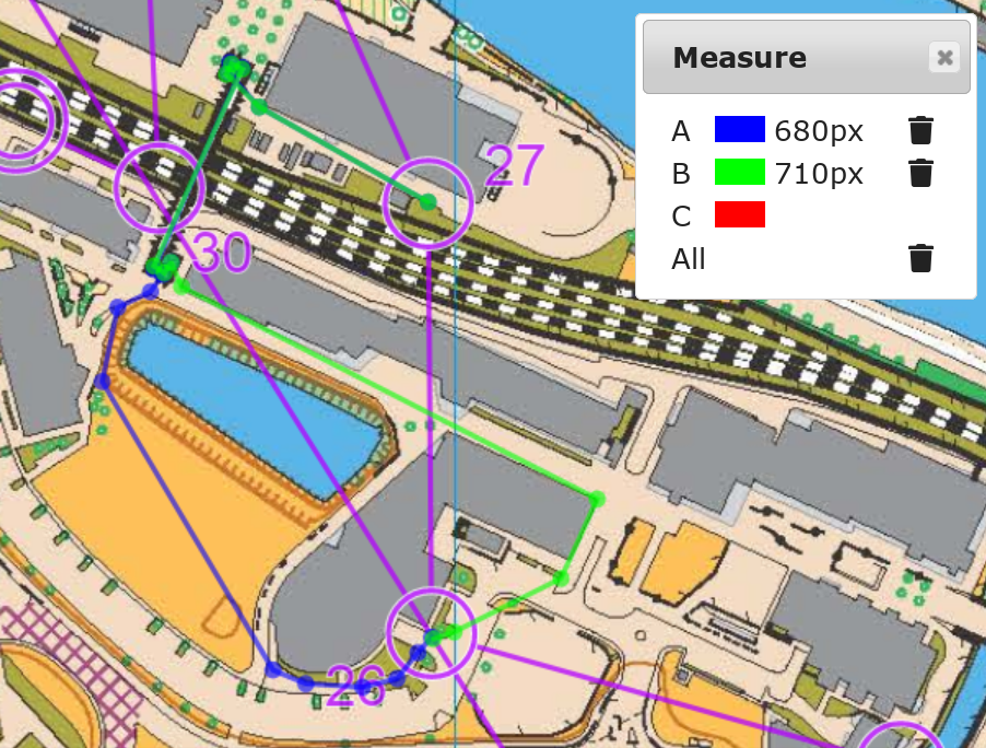
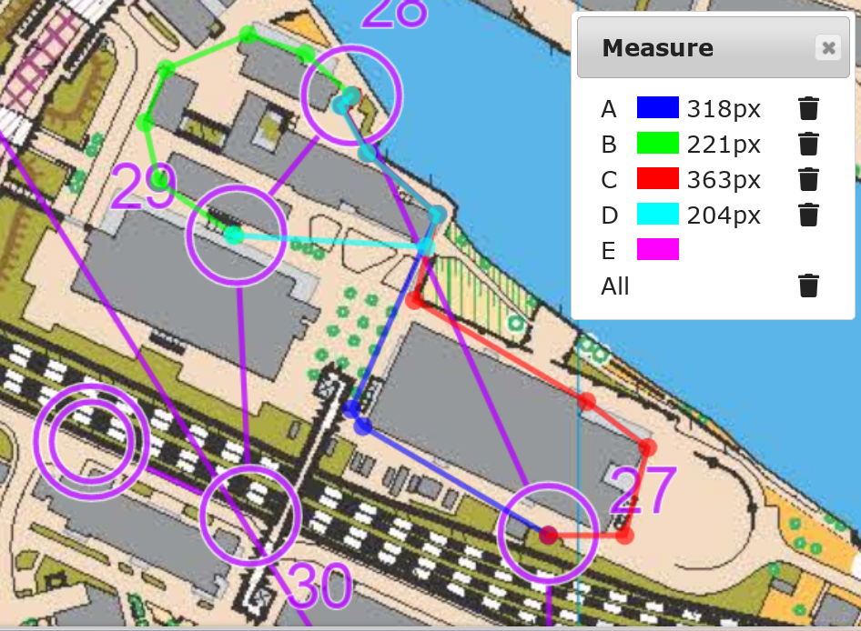
Control 26
I chose blue route A while the alternative was shown as green route B. It turned out that my route was slightly longer by 8 m.
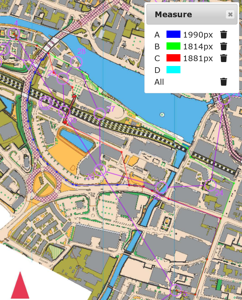
Control 27
I chose blue route A while the alternative was shown as green route B. My route was shorter by 19 m. However, the footbridge made me slow down which was shown as a 22-second mistake in the analysis.
Control 28 to finish
I chose blue route A and green route B for controls 28 and 29, while the alternative is shown as red route C and cyan route D.
I used the shorter route (29 m) to 28 but the longer route (11 m) to 29. However, as I had a smooth run (avoiding a U-turn which could easily cost seconds), both were shown as negative mistake in the analysis.
There were no route choices to control 30, just a bridge crossing. However, the mere act of getting up and down the footbridge produced 30 seconds of mistake time in the analysis, indicating that I was very weak in crossing bridges.
I completed the race in 1:17:45, 10th out of 13 finishers, with the winning time 0:54:12. The analysis showed my speed index was 120% and my mistake ratio was 11.1%, although it has been exaggerated by the map mistake at control 22 which contributed 2’53” alone out of 8’40” total. My GPS track is uploaded to Routegadget for comparison as well.
My Garmin watch showed the training effect as 5.0 aerobic and 4.0 anaerobic, which I have never seen such a large number before, and showed “rest recommended” and 72 hours recovery time.
Journey home
I didn’t have any friends doing this race as well. After the race, I still had a bit of time so I went to a supermarket to buy some food, as today is a Sunday that everywhere closes early.
I took the LNER train departing Lincoln 14:20 for London Kings Cross, scheduled to arrive at 16:20. The train arrived London 8 minutes early which enabled me to catch an earlier connecting Thameslink train, departing London St Pancras 16:24 instead of the one departing 16:54 as shown on my itinerary. The connecting Thameslink trains are unreservable so I can take any appropriate connections with my fixed-time ticket.